CuroInsights

Your drone data.
In context, secure and ready to act on.

Screenshot of a water infrastructure dataset interface showing a task list with columns like Inner ID, Completed, and Annotated by, along with timestamps and user names, and a map view displaying satellite imagery with a pipeline or network layout marked by connected white dots over red-brown terrain.

Deliver drone data the whole operational team can act on, with full traceability and built-in anomaly detection.

Compliance icon

Data that lives where you work, not buried in a folder

Every dataset delivered on an interactive map, tied to the booking that requested it. No drone expertise needed to know what you're looking at.
Orange outlined web browser window with a speech bubble containing horizontal lines connected to a central flower-like icon inside the window.

Drone data for the whole business, not just the drone team

Nominate any recipient at booking time. The whole operational team gets access, with no file permissions to manage.

Icon of four connected red-orange puzzle pieces forming a square shape with a slight shadow.

Secure by design, no loose links, no exceptions

No presigned URLs, no public cloud links, no email attachments, access requires an authenticated Curo login with full permission control.

Adaptable Any Site icon

Anomaly detection, powered by CuroAI

Inspection results arrive flagged and geolocated with CuroAI, so your team gets answers, not raw imagery to wade through.

Icon of an identification card outlined in orange with a user silhouette on the left and a checkmark in a circle on the top right, symbolising credential verification.

Tied to the booking that
requested it

Every dataset is automatically linked back to the booking that requested it, the pilot who flew it, the assets that captured it and the Operation that approved it.

Orange icon of a wrench crossed with a gear, symbolizing maintenance or technical support.

Built on Curo's governance foundation

Runs on the same compliance backbone as CuroRPA and CuroROC, with native Drone Safety App integration, ReOC frameworks and BVLOS-ready governance.
Download brochure
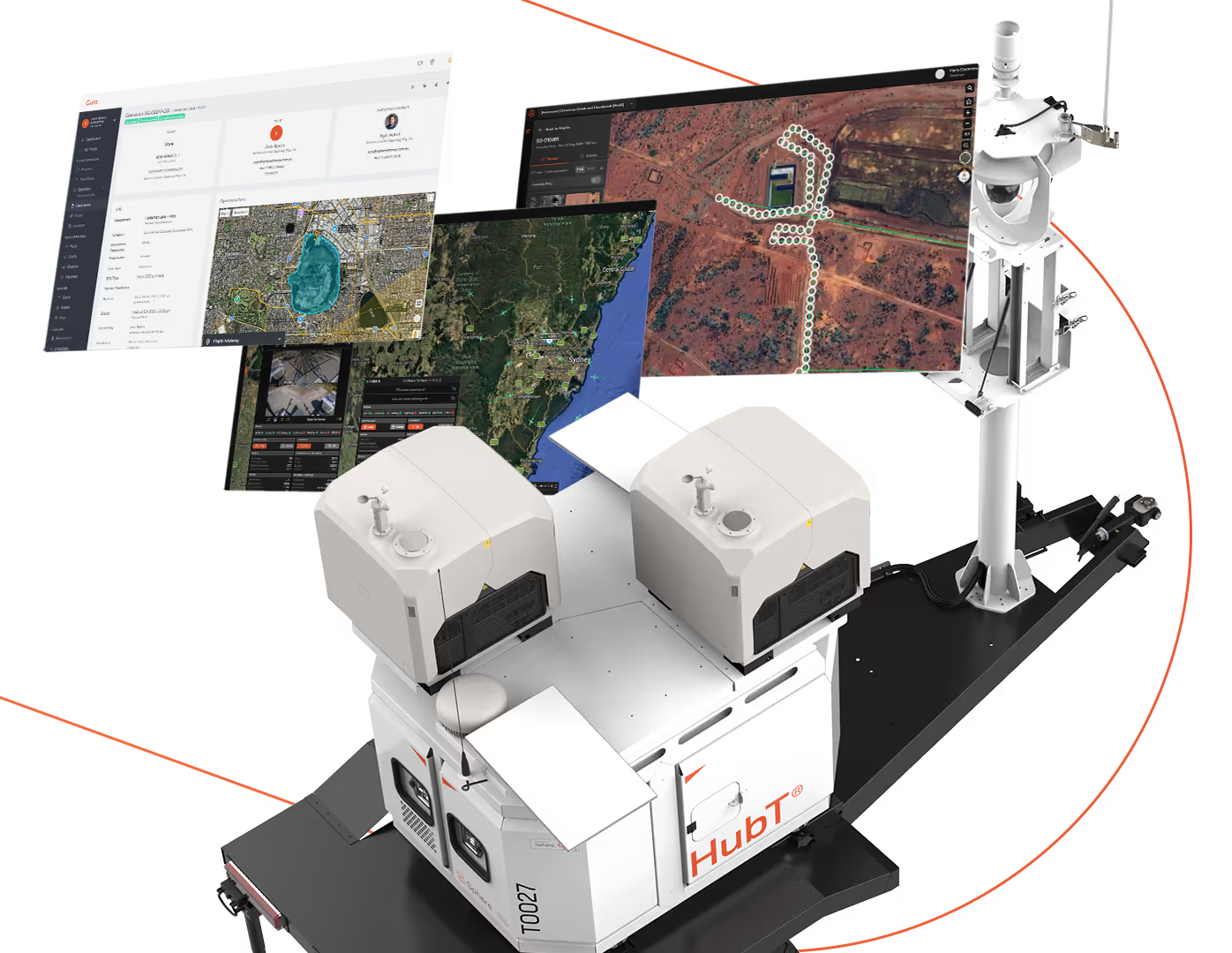
White autonomous robotic device labeled 'HubT' on a black base, equipped with twin cameras or sensors on top, shown alongside three floating digital screens displaying satellite maps, geographic data, and monitoring interfaces connected by an orange dotted line.

The data delivery and analytics layer of a complete Curo ecosystem.

CuroRPA handles the governance layer. CuroROC handles live operations. CuroInsights with CuroAI handles data delivery, processing and detection. Together with HubX and HubT, they form a complete remote data capture solution.

Hardware and software designed and engineered in Australia by the Sphere team, built to work as one.

Two construction workers in high-visibility vests and hard hats standing on a dusty site at sunset, one pointing ahead while the other holds a clipboard, with an excavator digging in the background.

Drone data delivery, from request to action.

CuroInsights is the customer-facing delivery and insights platform. Operations teams book data capture, track progress through delivery and receive the data in context on an interactive map, with AI-powered insights flagged ready to act on.
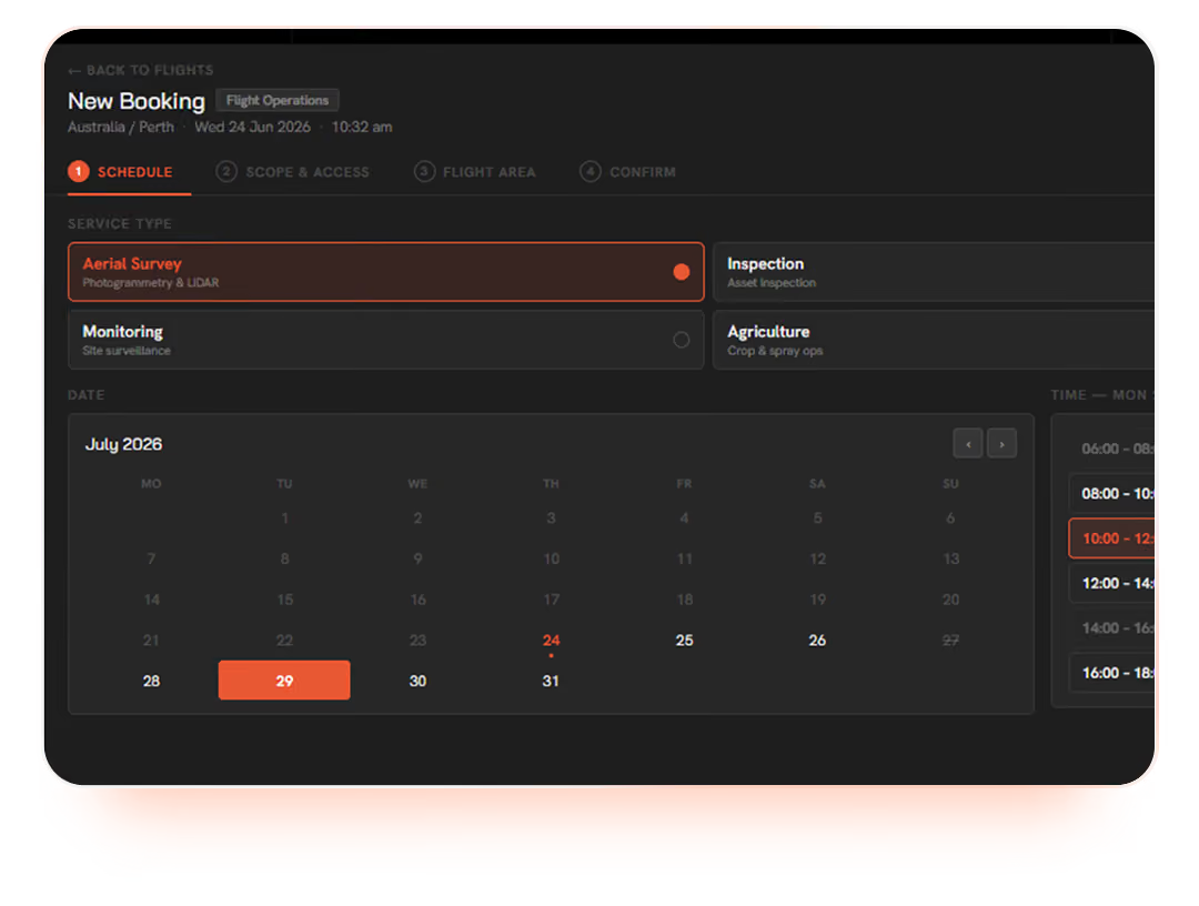
User interface for a new booking flight scheduler showing Australia/Perth with date Wednesday 24 June 2026 at 10:32 am. Service types listed include Aerial Survey, Inspection, Monitoring, and Agriculture, with Aerial Survey currently selected. A calendar for July 2026 highlights the 24th and the 29th, with the 29th selected. A time slot panel on the right shows available hours from 06:00 to 18:00 with 10:00 to 12:00 highlighted in orange.

Bookings drive delivery

Customers make bookings for the data they need, scoping the work, the deliverables and the recipients up front.

Every dataset that arrives is tied to the booking that created it, no orphaned files, no lost-in-translation handoffs.

Data delivered on an interactive map

Every dataset is displayed in geographic context, no drone expertise needed to know what you're looking at.

Pan, zoom, click into any frame and the underlying imagery, telemetry and CuroAI results are right there.
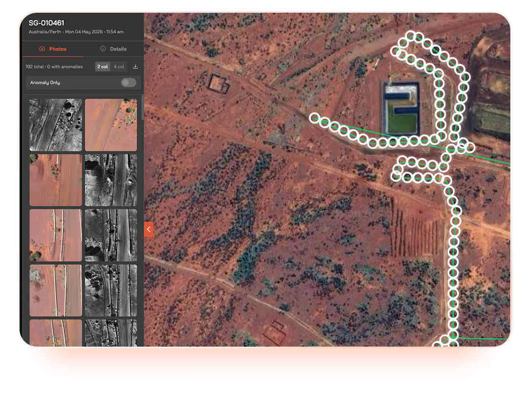
Satellite or aerial view of a reddish arid landscape with dirt roads and sparse vegetation, featuring a cluster of buildings and a path marked by connected white circles, shown within a software interface displaying image thumbnails and anomaly detection options dated 04 May 2026 in Perth, Australia.
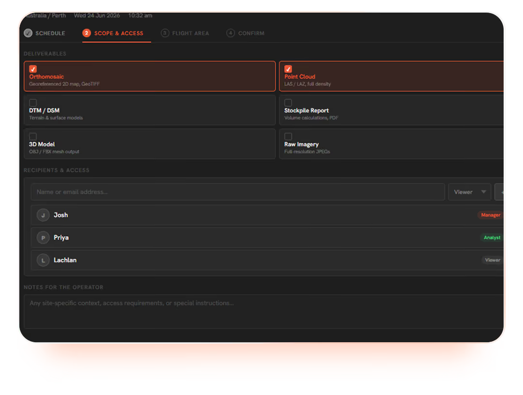
User interface screenshot showing a drone flight planning app focused on 'Scope & Access' section, with deliverables selected including Orthomosaic and Point Cloud, and recipients listed as Josh (Manager), Priya (Analyst), and Lachlan (Viewer).

Whole-team access, no file permissions to manage

Nominate any recipient at booking time and the whole operational team gets access. No shared drives to manage, no presigned URLs being forwarded around, no role confusion about who can see what.

Authenticated access, by default

Every access path requires an authenticated Curo login with full permission control. No presigned URLs, no public cloud links, no email attachments. Data goes from the field into the platform and stays there.
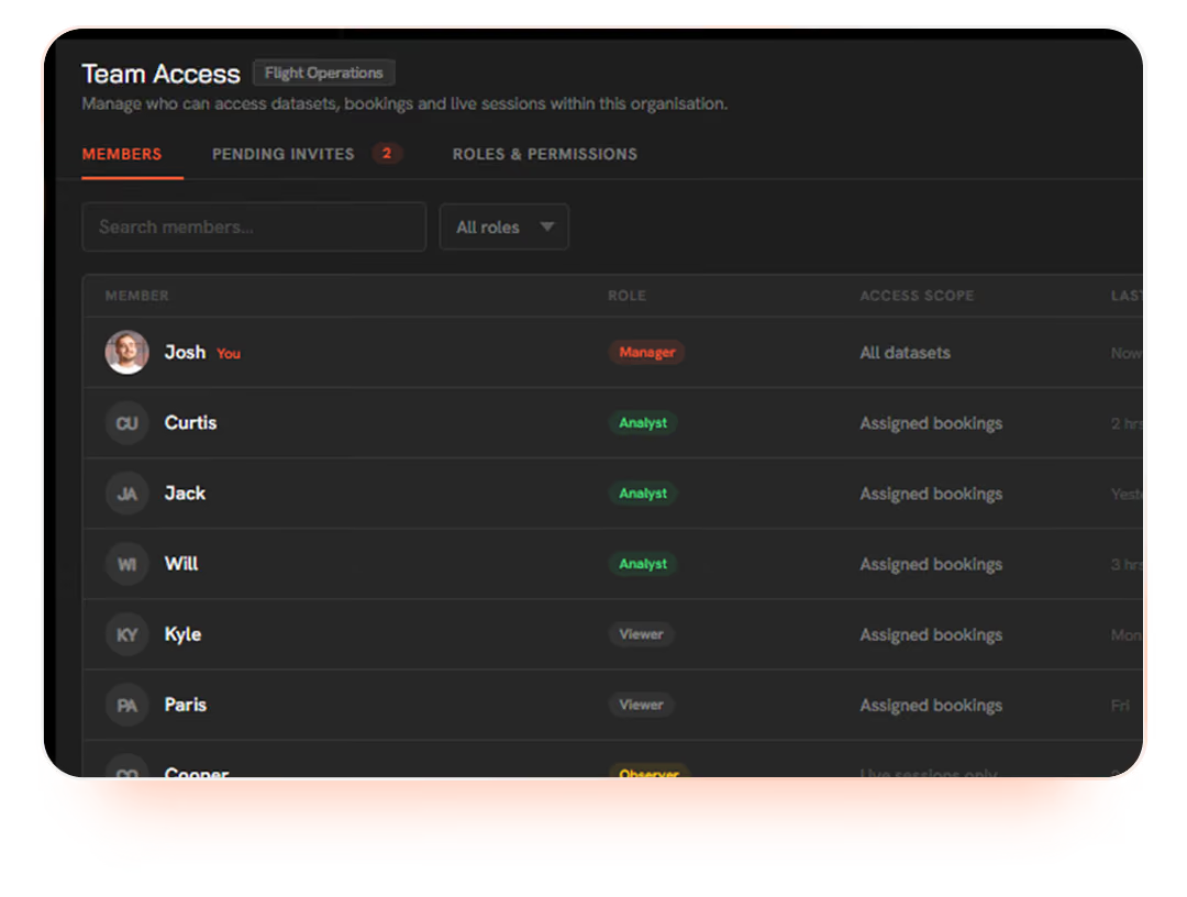
User interface showing Team Access settings in a software dashboard with tabs for Members, Pending Invites, Roles & Permissions. The Members tab lists users with roles such as Manager, Analyst, Viewer, and Observer alongside their access scopes like all datasets or assigned bookings.
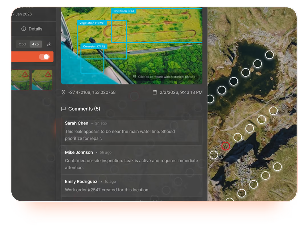
Interface showing an aerial map with vegetation and corrosion areas highlighted, coordinates and timestamp displayed, and comments from three users discussing a water leak and related work order.

Collaborative workflow on top of the data

Comment, assign actions, link work orders and resolve findings against the exact frame and location they relate to. Asset managers, field crews and project teams collaborate against the source data, not against screenshots in email.

Live session viewing and sharing

Customers and stakeholders can view live operations as they happen: link a session into a meeting, demonstrate progress to a regulator, or have an asset manager watching the same map as the remote pilot in real time.
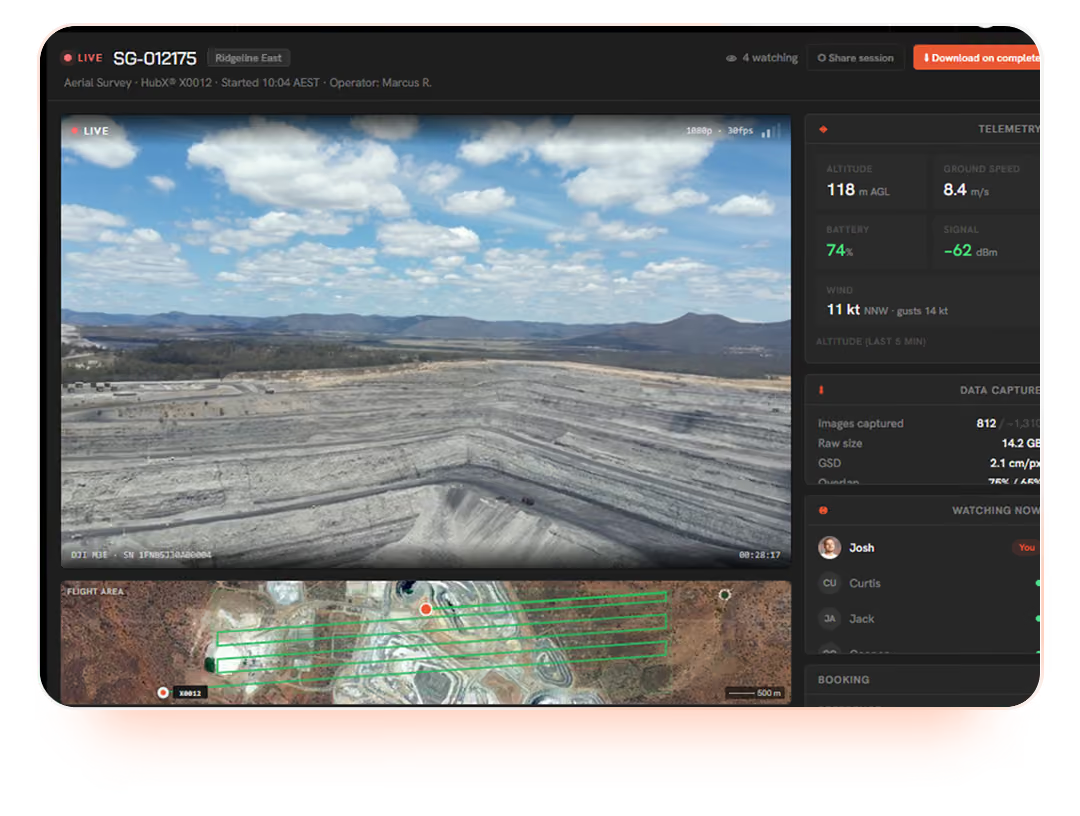
Drone live video feed showing a large open-pit mine with terraced slopes under a partly cloudy sky, alongside telemetry data including altitude, ground speed, battery level, and wind speed on the right, and a flight area map with a green grid below the live footage.

Get answers, not just imagery with CuroAI.

Every dataset delivered through CuroInsights can be run through CuroAI, our anomaly detection and classification layer. By the time the data reaches the people who need to act on it, the answers are already flagged, geolocated and waiting in context with the source imagery.
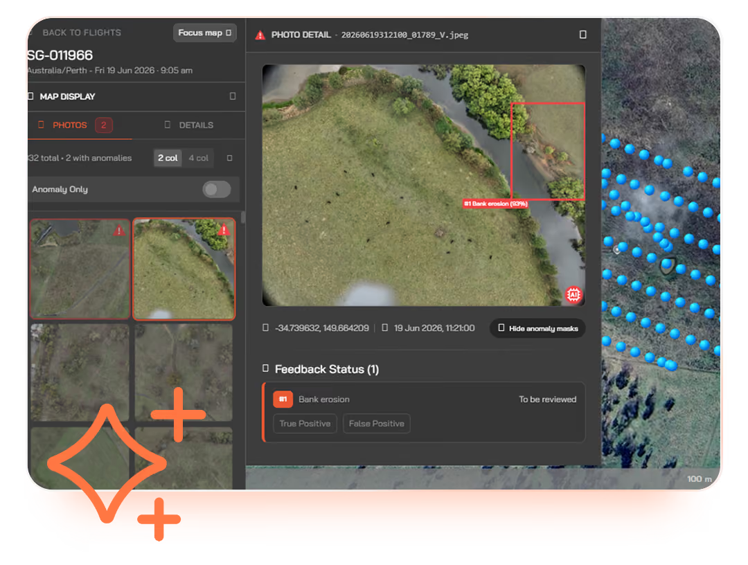
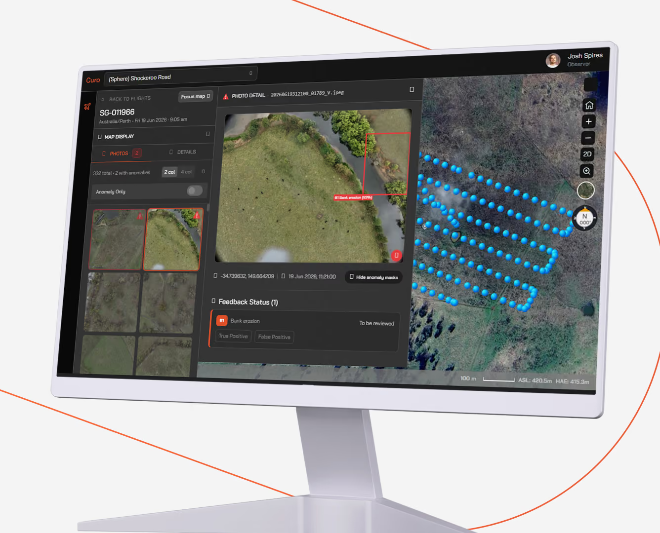
User interface displaying aerial images of land alongside a river, highlighting bank erosion with a red box and label. The screen shows photo details, map display options, anomaly detection toggle, feedback status for bank erosion, and coordinates with a timestamp. Blue dots mark locations on the map background, and navigation buttons are visible on the sides.

Anomaly detection at delivery time

Anomalies, defects and classifications of interest are detected automatically as part of the data delivery process. Your team opens the booking to answers, not to a folder of images to wade through.
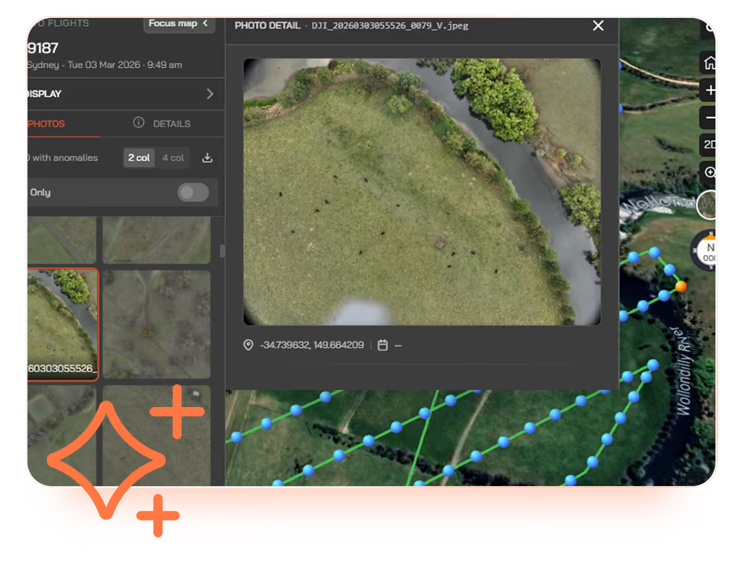
Screenshot of a drone mapping interface showing a photo detail of a grassy area with a river and green trees, overlaid with a flight path indicated by blue dots connecting points on a satellite map. Coordinates and flight information are visible on the screen.

Results posted in context with the source data

CuroAI results are posted back through the same booking, displayed on the same interactive map as the source imagery. Every flag is linked to its original frame and geolocation, so reviewing the call is one click away.
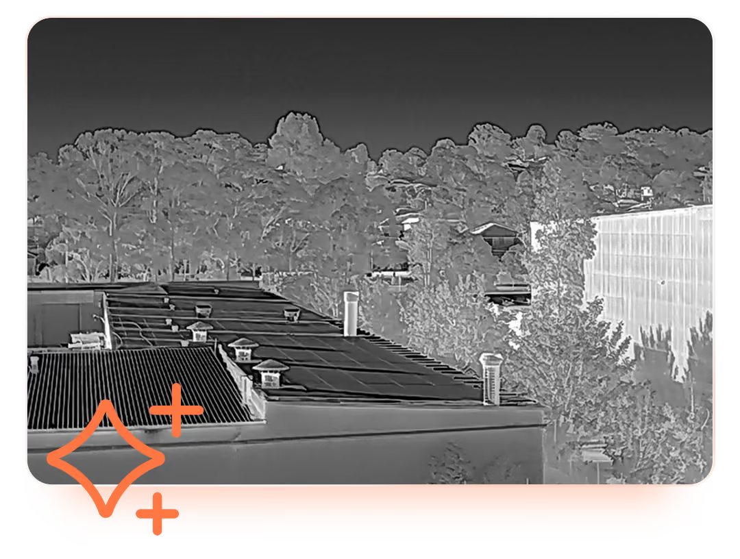
Thermal imaging view showing rooftops of buildings with several chimney vents and a dense tree line in the background under a dark sky.

Trained on real Australian operating environments

CuroAI models are developed and trained by Sphere's in-house data and machine learning team, using imagery from real Australian operating environments — mining, utilities, infrastructure, agribusiness. Not a generic global dataset shipped from offshore.
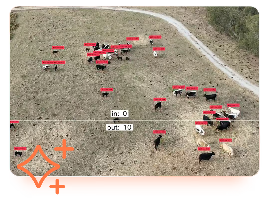
Aerial view of a grassy field with groups of cattle labelled with red identification tags, some black and white, some brown. A white line horizontally divides the image with text showing 'in: 0' above and 'out: 10' below, indicating cattle movement or count metrics. A dirt path curves along the upper right side of the field.

A growing model library

Common detection tasks include water and fluid leak detection, vegetation encroachment, asset condition assessment, perimeter monitoring, and rehabilitation tracking. New models are added to the platform over time, available to every CuroInsights customer at no additional licence cost.


Map of Australia composed of a dense pattern of evenly spaced orange dots, with occasional colorful overlays in yellow, blue, and pink creating a mosaic effect, and a black background.

More than 600TB of data already processed and analysed in CuroInsights, across the country.

The difference is integrated, not improvised or fragmented.

Curo Ecosystem
Diagram showing three interconnected modules labeled CuroRPA with a pencil and user icon, CuroROC with a play and save icon, and CuroInsights with a bar chart icon, illustrating a workflow or ecosystem.

One system, start to finish.

From approval to analytics, everything runs inside a single connected platform. Compliance is enforced automatically. Records link themselves. Your team focuses on the mission, not the admin.

Orange pencil icon inside a light peach circular background.
Plan
Flight approvals, handled in platform

Pilots submit flights and approvals are processed automatically against your operational rules, in line with CASA requirements. All in CuroRPA. No emails, no manual sign-offs.

Simplified orange user profile icon on a light circular background.
Credential
System-enforced pilot and asset gating

Pilots only see what they're qualified to fly in CuroRPA. Asset records and pilot credentials are linked automatically. If something is out of date, the system flags it before it becomes a risk.

Orange play button icon inside a light pink circle background.
EXECUTE
Remote command, control and live video

Flights are commanded and monitored through CuroROC, integrated into the same ecosystem. Operational data flows back into the platform the moment the mission ends.

Orange floppy disk icon on a light circular background, symbolizing saving or storage.
RECORD
Flight records that link themselves

Every flight automatically links to the pilot, aircraft, procedure and approval it belongs to. Your compliance record builds itself, no manual data entry, no gaps.

Four ascending vertical bars in orange inside a pale pink circle, representing a rising bar chart or signal strength indicator.
ANALYSE
Data delivery and analytics

Operational data surfaces directly in CuroInsights with no export or re-entry. Trends, utilisation and compliance metrics are always current, always accessible.
Traditional Approach
Seven floating square icons representing different functions, including a bar chart, pencil, user profile, floppy disk save symbol, play button, user profile, and bar chart again, all on a transparent background.

Pieced together. Held together manually.

Traditional drone compliance management has work spread across email threads, spreadsheets and disconnected tools. Compliance depends on someone remembering to update the right file. Records are reconciled by hand, usually after the fact. Your team spends as much time managing the paperwork as managing the program.

Orange pencil icon inside a light peach circular background.
Plan
Approvals over email, approved on good faith

Flight requests are submitted manually, usually via email or a form. Approval depends on someone being available and informed. Rules are assumed instead of being enforced.

Simplified orange user profile icon on a light circular background.
Credential
Pilot and asset records in separate spreadsheets

Qualifications and maintenance logs are tracked manually, often by different people in different files. Keeping them current is a task in itself, and they're rarely in sync.

Orange play button icon inside a light pink circle background.
EXECUTE
Separate tools for flight control and compliance

Execution software and compliance records exist in different systems with no connection between them. What happens in the field has to be manually reconciled with what's on paper.

Orange floppy disk icon on a light circular background, symbolizing saving or storage.
RECORD
Manual flight logs, filled in after the fact

Flight logs are filled out by hand, or manually uploaded at the office. The quality of your compliance record depends entirely on the discipline of whoever is holding the pen.

Four ascending vertical bars in orange inside a pale pink circle, representing a rising bar chart or signal strength indicator.
ANALYSE
Analytics built manually, when time allows

Any operational insight requires someone to pull data from multiple sources, clean it, and build a report by hand. By the time it's ready, it's already out of date.

CuroInsights is where data is delivered.

CuroInsights is the data delivery layer of the Curo suite. Operations approved in CuroRPA and flown through CuroROC arrive in CuroInsights automatically. The compliance record, the live operation and the data delivery are the same record, never duplicated, never reconciled by hand.
Capability CuroRPA CuroROC CuroInsights
Flight approvals
Flight record keeping
Pilot management
Asset management
Procedures & checklists
Remote command & control
Live video streams
3D virtual environment
Mission planning & scheduling
Live ADS-B, airband radio, weather
Customer flight requests
Data delivery
AI analytics delivery
Seamless integration with HubX & HubT
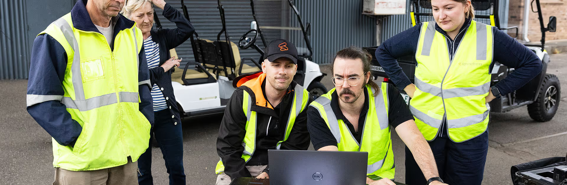
Group of five workers in high-visibility vests gathered around a laptop outdoors, appearing focused and discussing something important.

Easy, hassle free setup.

Our team works closely with yours to migrate your existing program into CuroInsights, configure it to your operating context and have you audit-ready from day one. We work closely with your team to ensure the optimal solution is seamlessly implemented onto your site.

1

We get to know you, your assets, team, sites and needs.

2

We tailor your CuroInsights instance to you, built for the way you operate.

3

We continuously support and improve your drone program as it evolves.
Deploy CuroInsights on the hardware it was built for or with your existing fleet.

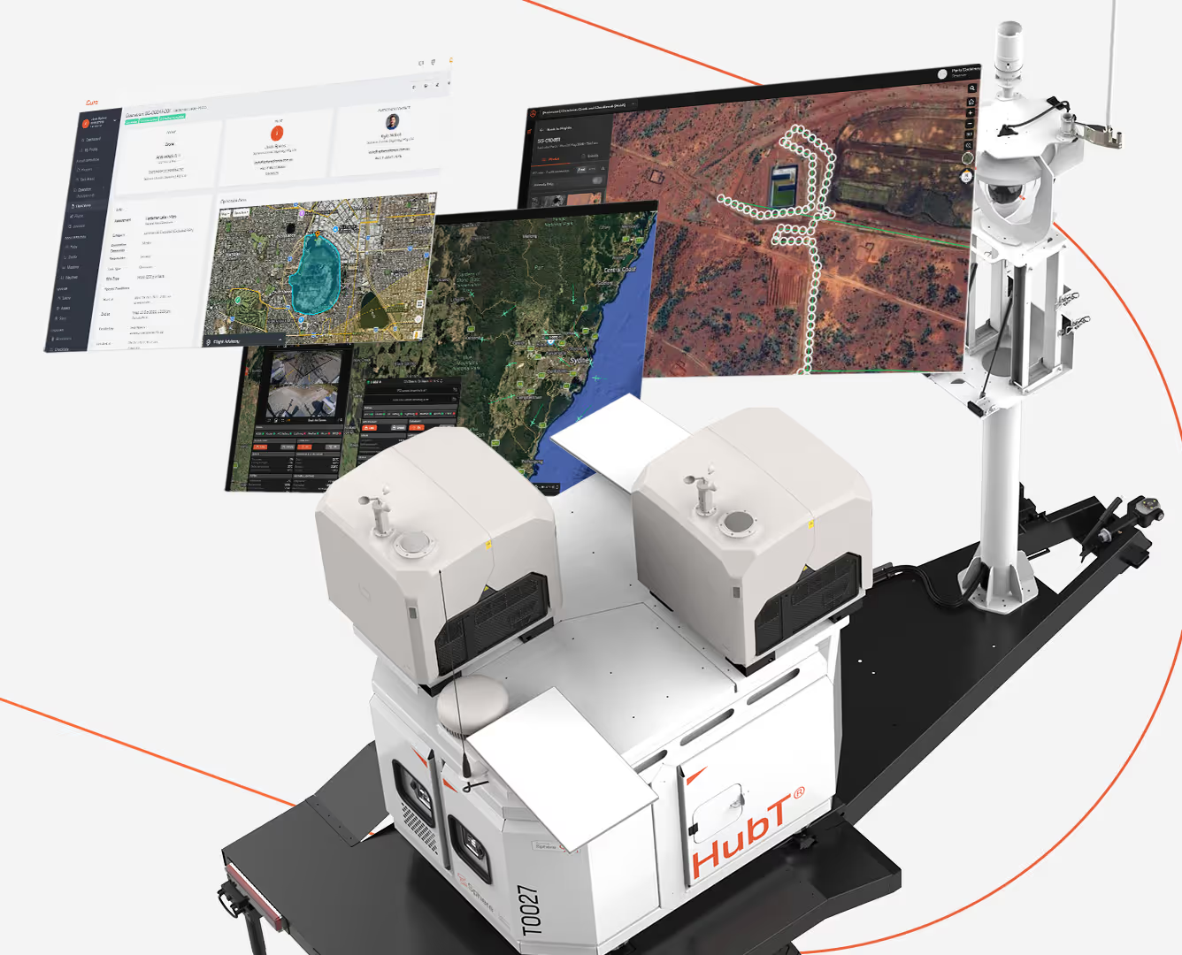
A HubT branded automated mobile unit with sensors and equipment mounted on a platform, displaying three floating digital maps and data screens showing geographic and satellite imagery with routes and measured areas.
The hardware and software, built for each other.

Best suited to operators standing up a new drone program, or those looking to replace a fragmented setup with a single, integrated and purpose-built system.
  • HubX® or HubT® paired with CuroRPA, CuroROC and CuroInsights: Governance, execution and data delivery connected by design
  • Complete drone program ready to operate from day one, no integration work or compatibility questions
  • Scales with your operation without adding tools or complexity
Talk to us about pricing
Computer monitor displaying an aerial mapping software interface with a top-down view of a green landscape and a riverbank, showing blue markers in grid formation, photo detail window highlighting bank erosion, and user name Josh Spires in top right.
Data delivery and analytics software for your existing drone program.

Best suited to operators who already capture data and need a better way to deliver and act on it.

As the foundation layer of the Curo suite, CuroRPA is required for CuroInsights.

  • Delivers your drone data on an interactive map, without changing how you capture it
  • Whole-team access with authentication built in, scaling with your program as it grows
  • Anomaly detection with CuroAI at delivery time, with a clear upgrade path to the full Hub and Curo suite when you're ready
Talk to us about pricing
A HubT branded automated mobile unit with sensors and equipment mounted on a platform, displaying three floating digital maps and data screens showing geographic and satellite imagery with routes and measured areas.
Computer monitor displaying an aerial mapping software interface with a top-down view of a green landscape and a riverbank, showing blue markers in grid formation, photo detail window highlighting bank erosion, and user name Josh Spires in top right.
White autonomous robotic device labeled 'HubT' on a black base, equipped with twin cameras or sensors on top, shown alongside three floating digital screens displaying satellite maps, geographic data, and monitoring interfaces connected by an orange dotted line.

Don't want to manage drone data delivery yourself?

CuroInsights is also available as a fully managed data service. Sphere's in-house data and engineering team plans the capture, processes the data, runs the CuroAI models and delivers the answers directly into CuroInsights for your operational team. You get the outcome, not the workflow.

FAQs

Do I need CuroRPA or CuroROC to use CuroInsights?
What is CuroAI, and is it a separate product?
What kinds of things can CuroAI detect?
How is CuroInsights different from sending people a Dropbox or Google Drive link?
Can my colleagues access the data without having to log in to Curo?
Where is my data hosted?
Can CuroInsights integrate with our existing systems (GIS, asset management, work order)?
What file formats does CuroInsights support?
Can Sphere capture and process the data for us as a managed service?
What happens to our data if we stop using Curo?
Is there a minimum program size for CuroInsights?

Stop emailing zip files of imagery.

Get in touch with our team for a walkthrough of CuroInsights, scoped to your drone program.

Related articles

Download brochure

(*Mandatory fields)

Thank you! Your submission has been received!
Oops! Something went wrong while submitting the form.