
CuroROC

Live drone operations.
Governed from the ground up.

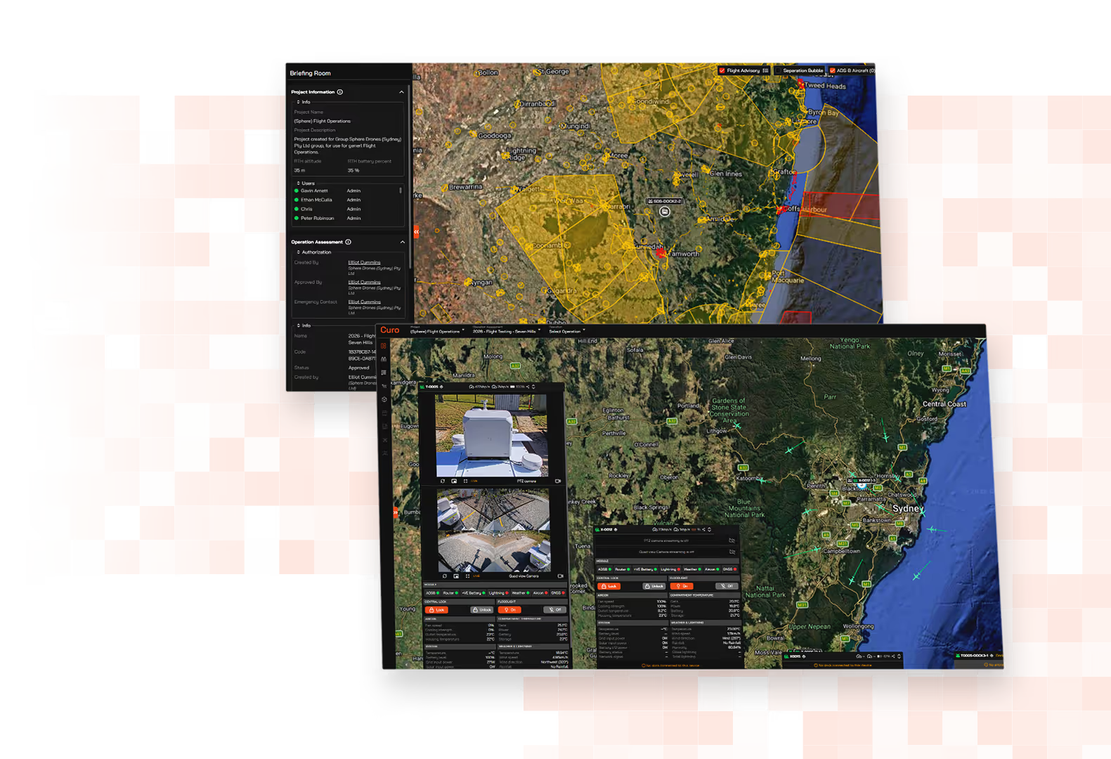
Two overlaid computer screens showing detailed geographic maps with highlighted areas and control panels, including satellite views and location markers, with one screen focused on a region near Sydney, Australia.

Run compliant remote and BVLOS operations from anywhere, with full situational awareness and compliance enforcement.

Icon of an identification card outlined in orange with a user silhouette on the left and a checkmark in a circle on the top right, symbolising credential verification.

Compliance enforced in real-time,
not just on paper

Only approved pilots fly. Credentials and geofences are enforced automatically at the point of operation.

Adaptable Any Site icon

One operating picture,
no context switching

Live video, ADS-B traffic, weather, telemetry and dock command unified in a single interface. No five screens, no fragmented tools.

Orange icon of a wrench crossed with a gear, symbolizing maintenance or technical support.

Purpose-built for
Australian BVLOS

CASA-verified airspace advisory, OzRunways EFB traffic integration and Broad Area BVLOS Self-Assessment alignment, designed for how Australian operators fly.

Built Tough icon

Automatic records,
zero manual reconciliation

Every flight syncs back to CuroRPA, linked to the pilot, aircraft, operation and mission parameters. Always current, without anyone having to touch it.

HubX Modular Payload Bay icon

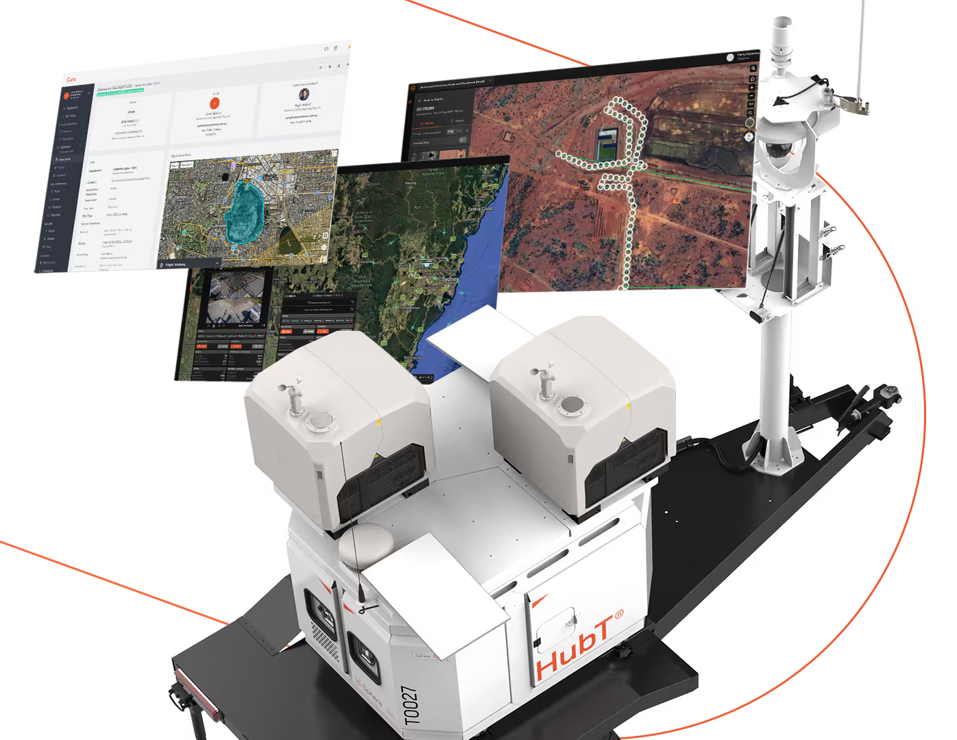
HubX® and HubT® integrated, natively

CuroROC brings Sphere's Hub infrastructure into a single interface, combining dock command, 360° and PTZ site cameras, ADS-B traffic and real-time weather telemetry from on-Hub stations.

Sphere Remote Operations Centre icon

 One ROC,
every site

Run remote and BVLOS operations across multiple sites from a single interface. Pilots in one place, drones across every site, with a shared operating picture and unified scheduling.
Download brochure
White autonomous robotic device labeled 'HubT' on a black base, equipped with twin cameras or sensors on top, shown alongside three floating digital screens displaying satellite maps, geographic data, and monitoring interfaces connected by an orange dotted line.

The live operations layer of a complete Curo ecosystem.

CuroRPA handles the governance and compliance layer. CuroROC handles live operations. CuroInsights with CuroAI handles data delivery, processing and detection. Together with HubX and HubT, they form a complete remote data capture solution.

Hardware and software designed and engineered in Australia by the Sphere team, built to work as one.
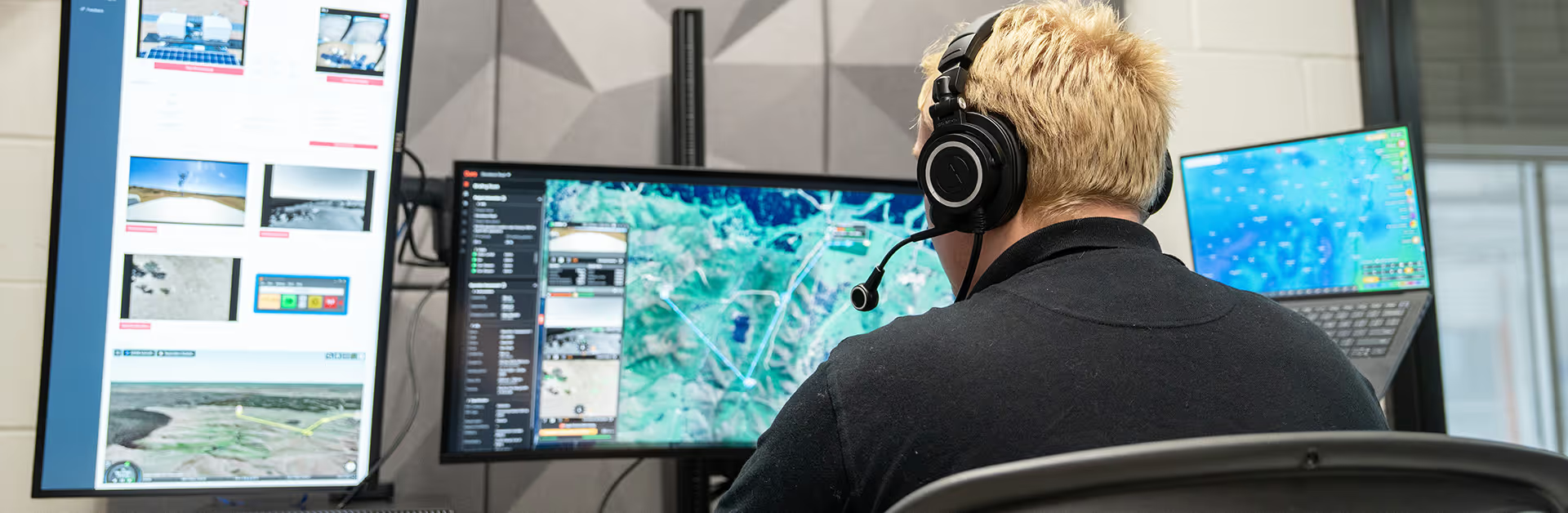
Person wearing headphones and a black shirt sits facing three large computer monitors displaying maps and geographic data in a modern office setting.

Close the gap between what's approved and what's happening in the air.

Built directly on CuroRPA, CuroROC enforces your compliance rules in real-time so your pilots have everything they need to fly safely, and your compliance record is always current and always complete.
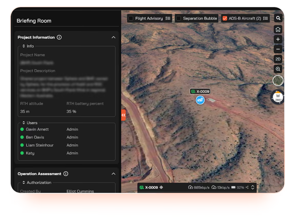
Interface of a briefing room showing a project overview with user details on the left and a 3D aerial map on the right displaying terrain and a marked location labeled X-0009 with connectivity and status icons.

Compliance enforced at the point of operation

Only pilots with a valid, open Operation in CuroRPA can fly in CuroROC. The approved operational area becomes the live geofence automatically, drawn directly from the CuroRPA Operation Assessment. There is no manual setup, no workarounds and no gap between the approved plan and what happens in the air.

Live drone command and dock control

Full DJI Dock command and control through the DJI Cloud API integration. Remote pilots manage launch, mission execution, return-to-home, payload control and post-flight processing from a single interface, without switching tools.

Drone control interface showing live camera feeds and a satellite map of a remote site with equipment surrounded by a dirt area, including solar panels and safety cones.
Map showing multiple aircraft icons around Sydney and nearby locations including Cowra, Dubbo, and Wollongong, with a data overlay listing aircraft ICAO codes, altitudes in meters, horizontal and vertical velocities in meters per second, and checkboxes for visibility selection.

Live ADS-B plus OzRunways EFB community traffic

Real-time ADS-B traffic in the same interface as the live operation, supplemented by OzRunways EFB community traffic data. Together they cover the low-altitude visibility gaps in remote environments where public ADS-B coverage is weakest, giving remote pilots traffic awareness GA pilots would recognise.

Native CASA RPAS Platform airspace data

Airspace advisory is built on the same audited and approved CASA RPAS Platform integration as CuroRPA. Data is supplied directly from Airservices Australia and other official source providers, not a third-party generic dataset.
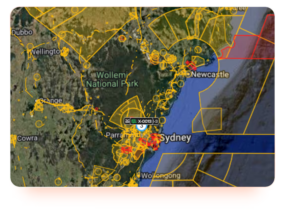
Map showing part of New South Wales, Australia, including Sydney, Newcastle, Wollongong, and Wollemi National Park, overlaid with numerous yellow and red flight navigation zones and markers indicating controlled airspace.
Drone flight planning software interface showing map with terrain and planned flight path over a site, including distance, duration, and photo count details, aircraft model options, lens selection, photo collection modes, ground sampling distance, and altitude mode controls.

Mission planning and scheduling

Plan and schedule recurring autonomous operations across one site or many, all from a single console. Schedule overnight inspection runs, recurring perimeter sweeps, or coordinated multi-site captures and let CuroROC manage execution and enforcement.
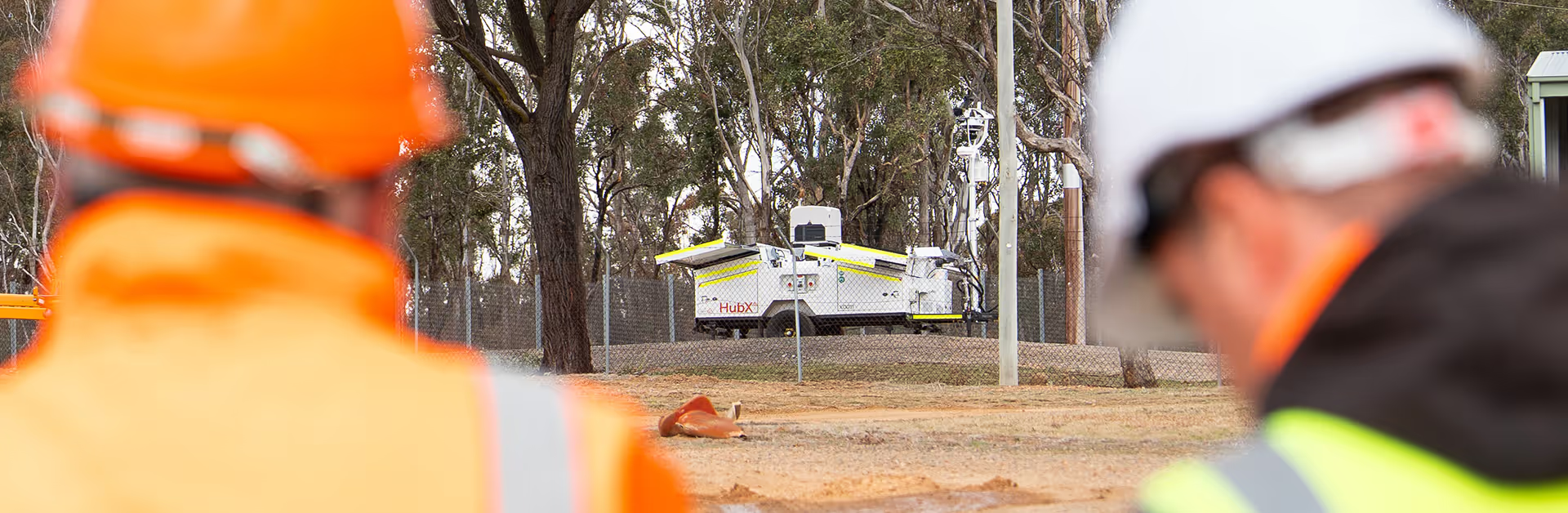
Two workers wearing orange and yellow safety gear and hard hats observe a mobile unit labeled HubX situated in a fenced outdoor area with trees in the background.

Unlock the full operating picture with HubX and HubT.

CuroROC integrates natively with Sphere's HubX and HubT infrastructure, bringing dock command, site cameras, environmental telemetry and ADS-B into a single operating window.
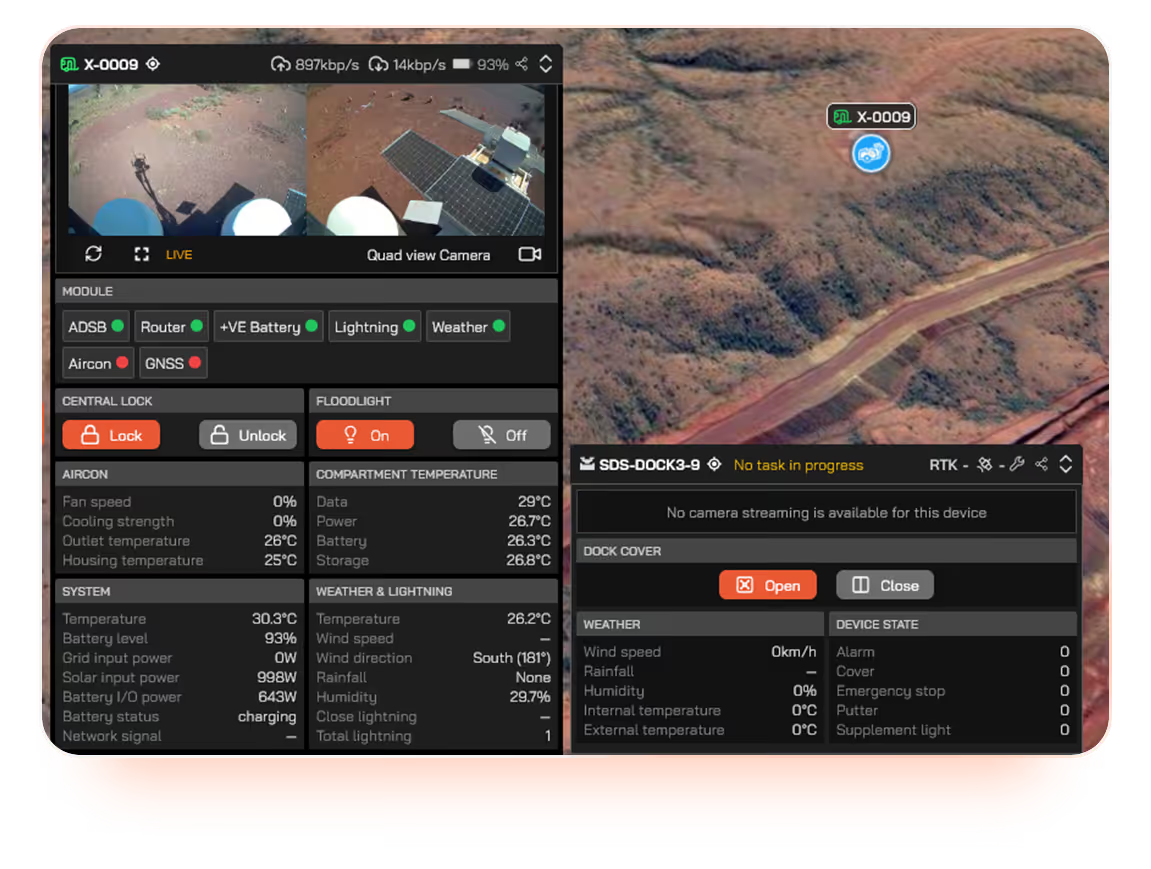
User interface screen displaying telemetry data and controls for device X-0009, including quad view camera feed, module status with ADSB, router, battery, lightning, weather, aircon, and GNSS indicators, central lock buttons, floodlight on/off, aircon temperatures, system info with temperature, battery level, power inputs, charging status, network signal, weather and lightning conditions like temperature, wind speed and direction, rainfall, humidity, close and total lightning counts, and dock cover control with no camera streaming available, plus weather and device state details including wind speed 0 km/h, zero alarms, emergency stops, and supplement light off.

On-Hub environmental telemetry

Real-time wind speed, temperature, humidity and lightning data from on-Hub weather stations, surfaced directly in the operating interface. Go/no-go decisions are based on site-specific conditions, not the nearest regional forecast.

Screen showing live video feed and aerial map of a white weather or surveillance station with solar panels positioned on desert terrain; video panels include close-up and panoramic outdoor views around the station with orange cones nearby; map highlights the location labeled X-0009 in a remote area with sparse vegetation.

Unified live video and site visibility

Live 360° and PTZ site camera feeds from HubX and HubT, with remotely controlled floodlights for low-light operations. Pilots maintain visual situational awareness of both the aircraft and the operating environment from anywhere in the country.
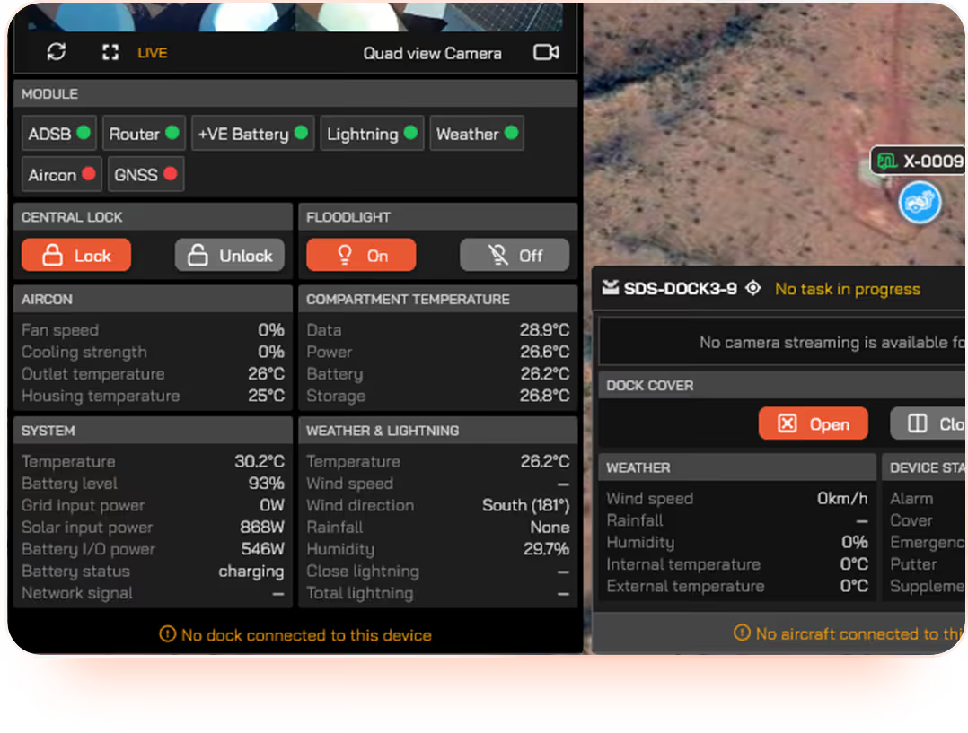
User interface screen showing live quad view camera status with multiple modules indicating connectivity and activity, air conditioning and floodlight controls, compartment temperature data, system and weather information including temperature, battery status, wind speed and direction, humidity, and lightning details, with notifications about no dock or aircraft connected and dock cover open option.

Hub command alongside dock control

HubX and HubT infrastructure is controlled from the same interface as your DJI Dock deployments so there’s no separate tool or context switching. Take full command of your entire deployed footprint in one operating window.

Orange line icon of a person wearing a construction helmet standing beside a control panel with four circular buttons.

Built by operators, for operators.

CuroROC is the same platform Sphere's own operations run on, built by a team that holds a ReOC, a Broad Area BVLOS Approval and a ROC.

The difference between integrated and improvised.

Curo Ecosystem
Diagram showing three interconnected modules labeled CuroRPA with a pencil and user icon, CuroROC with a play and save icon, and CuroInsights with a bar chart icon, illustrating a workflow or ecosystem.

One system, start to finish.

From approval to analytics, everything runs inside a single connected platform. Compliance is enforced automatically. Records link themselves. Your team focuses on the mission, not the admin.

Orange pencil icon inside a light peach circular background.
Plan
Flight approvals, handled in platform

Remote pilots submit flights and approvals are processed automatically against your operational rules, in line with CASA requirements. All in CuroRPA. No emails, no manual sign-offs.

Simplified orange user profile icon on a light circular background.
Credential
System-enforced pilot and asset gating

Remote pilots only see what they're qualified to fly in CuroROC. Asset records and pilot credentials are linked automatically. If something is out of date, the system flags it before it becomes a risk.

Orange play button icon inside a light pink circle background.
EXECUTE
Remote command, control and live video

Flights are commanded and monitored through CuroROC, integrated into the same ecosystem. Operational data flows back into the platform the moment the mission ends.

Orange floppy disk icon on a light circular background, symbolizing saving or storage.
RECORD
Flight records that link themselves

Every flight automatically links to the pilot, aircraft, procedure and approval it belongs to. Your compliance record builds itself, no manual data entry, no gaps.

Four ascending vertical bars in orange inside a pale pink circle, representing a rising bar chart or signal strength indicator.
ANALYSE
Data delivery and analytics

Operational data surfaces directly in CuroInsights with no export or re-entry. Trends, utilisation and compliance metrics are always current, always accessible.
Traditional Approach
Seven floating square icons representing different functions, including a bar chart, pencil, user profile, floppy disk save symbol, play button, user profile, and bar chart again, all on a transparent background.

Pieced together. Held together manually.

Traditional drone compliance management has work spread across email threads, spreadsheets and disconnected tools. Compliance depends on someone remembering to update the right file. Records are reconciled by hand, usually after the fact. Your team spends as much time managing the paperwork as managing the program.

Orange pencil icon inside a light peach circular background.
Plan
Approvals over email, approved on good faith

Flight requests are submitted manually, usually via email or a form. Approval depends on someone being available and informed. Rules are assumed instead of being enforced.

Simplified orange user profile icon on a light circular background.
Credential
Pilot and asset records in separate spreadsheets

Qualifications and maintenance logs are tracked manually, often by different people in different files. Keeping them current is a task in itself, and they're rarely in sync.

Orange play button icon inside a light pink circle background.
EXECUTE
Separate tools for flight control and compliance

Execution software and compliance records exist in different systems with no connection between them. What happens in the field has to be manually reconciled with what's on paper.

Orange floppy disk icon on a light circular background, symbolizing saving or storage.
RECORD
Manual flight logs, filled in after the fact

Flight logs are filled out by hand, or manually uploaded at the office. The quality of your compliance record depends entirely on the discipline of whoever is holding the pen.

Four ascending vertical bars in orange inside a pale pink circle, representing a rising bar chart or signal strength indicator.
ANALYSE
Analytics built manually, when time allows

Any operational insight requires someone to pull data from multiple sources, clean it, and build a report by hand. By the time it's ready, it's already out of date.

CuroROC is where remote operations take flight.

CuroROC is the execution layer where approved operations become live flights. It sits on top of CuroRPA's governance foundation and feeds completed flight data downstream into CuroInsights, so every part of the chain is auditable, accurate and traceable back to source.

Capability CuroRPA CuroROC CuroInsights
Flight approvals
Flight record keeping
Pilot management
Asset management
Procedures & checklists
Remote command & control
Live video streams
3D virtual environment
Mission planning & scheduling
Live ADS-B, airband radio, weather
Customer flight requests
Data delivery
AI analytics delivery
Seamless integration with HubX & HubT

Discover what fully integrated BVLOS operations look like.


See the complete Curo suite and Hub infrastructure working together in practice.

Book a live 1-on-1 demo with our team and get a real-time look at how our Remote Operations Centre runs BVLOS drone operations: compliantly, efficiently and at scale.
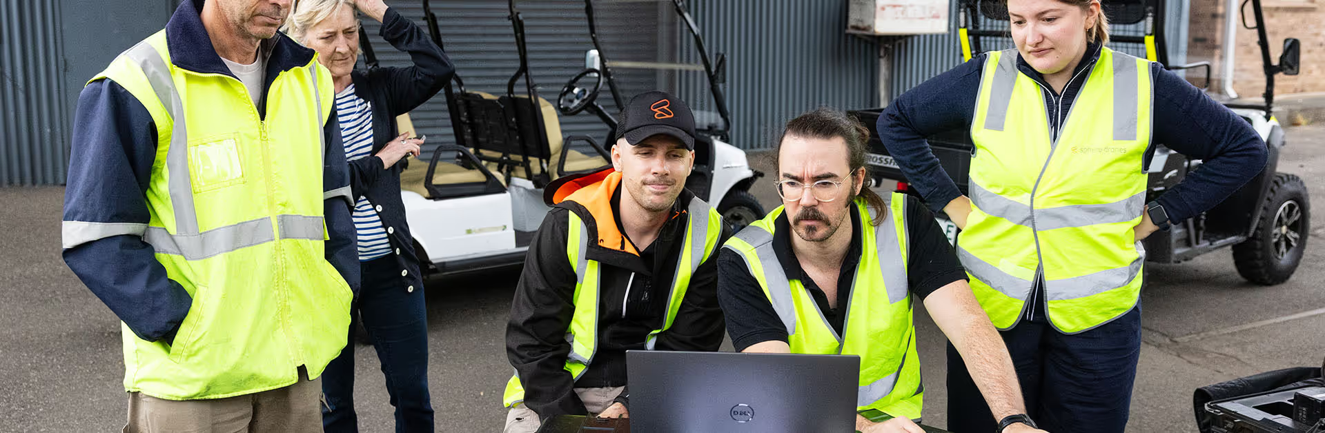
Group of five workers in high-visibility vests gathered around a laptop outdoors, appearing focused and discussing something important.

Easy, hassle free setup.

Our team works closely with yours to migrate your existing program into CuroROC, configure it to your operating context and have you audit-ready from day one. We work closely with your team to ensure the optimal solution is seamlessly implemented onto your site.

1

We get to know you, your assets, team, sites and needs.

2

We tailor your CuroROC instance to you, built for the way you operate.

3

We continuously support and improve your drone program as it evolves.
Wherever your program is today, there’s a clearer path forward.

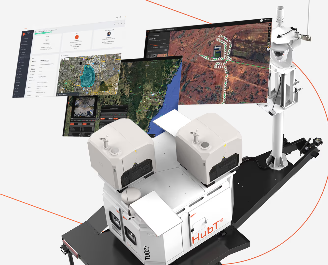
A HubT branded automated mobile unit with sensors and equipment mounted on a platform, displaying three floating digital maps and data screens showing geographic and satellite imagery with routes and measured areas.
The hardware and software, built for each other.

Best suited to operators standing up a new drone program, or those looking to replace a fragmented setup with a single, integrated and purpose-built system.

  • HubX® or HubT® paired with CuroRPA, CuroROC and CuroInsights: Governance, execution and data delivery connected by design
  • Complete drone program ready to operate from day one, no integration work or compatibility questions
  • Scales with your operation without adding tools or complexity
Talk to us about pricing
Computer monitor displaying Curo drone flight planning software with multiple interface panels including project information, user roles, live video feeds, flight advisory data, and operational controls set over a terrain map.
Live operations and compliance enforcement.

Best suited to operators who already have a compliance program in place and need a dedicated live operations platform to run remote and BVLOS flights on.

As the foundation layer of the Curo suite, CuroRPA is required for CuroROC
  • Only qualified pilots fly, and only within approved areas, enforced automatically
  • Full situational awareness of your airspace, without cobbling together separate tools
  • Every flight on the record from the moment it ends, with no manual reconciliation
Talk to us about pricing
A HubT branded automated mobile unit with sensors and equipment mounted on a platform, displaying three floating digital maps and data screens showing geographic and satellite imagery with routes and measured areas.
Computer monitor displaying Curo drone flight planning software with multiple interface panels including project information, user roles, live video feeds, flight advisory data, and operational controls set over a terrain map.
Orange outline of a house with two pill-shaped objects inside and three curved signal waves above the roof.

Don’t have a remote pilot team yet?

If you have the operational demand but not the in-house Remote Operations Centre capability to match, Sphere's team can bridge the gap.

Let our Sydney-based remote pilots use CuroROC to fly your BVLOS operations for you: the same platform, the same team, contracted to your outcomes.

FAQs

How is CuroROC different from DJI FlightHub 2?
Do I need CuroRPA to use CuroROC?
Is CuroROC built for BVLOS specifically?
Can I use CuroROC without HubX or HubT?
Does CuroROC work with our existing business systems?
Is the CuroROC platform hosted in Australia?
Can Sphere operate the ROC for us?
What happens to our data if we stop using Curo?
Is CuroROC a commercial product today?
Does CuroROC support multi-site operations?

Stop flying operations without full situational awareness.

Get in touch with our team for a walkthrough of CuroROC, scoped to your drone program.

Related articles

Download brochure

(*Mandatory fields)

Thank you! Your submission has been received!
Oops! Something went wrong while submitting the form.