10x photon sensitivity
Ensures the capture of rich and detailed pointclouds
9min max flight time
Capture more data in a single flight
Zero artifacts
Artifact-free data capture for perfect results everytime
Up to 100m range
Capture data further from the drone, saving time
1,3 M pts / sec scanning rate
Capture higher resolution pointclouds in shorter times
±6 mm precision (1σ)
High precision data ensures its perfect for survey-grade data collection

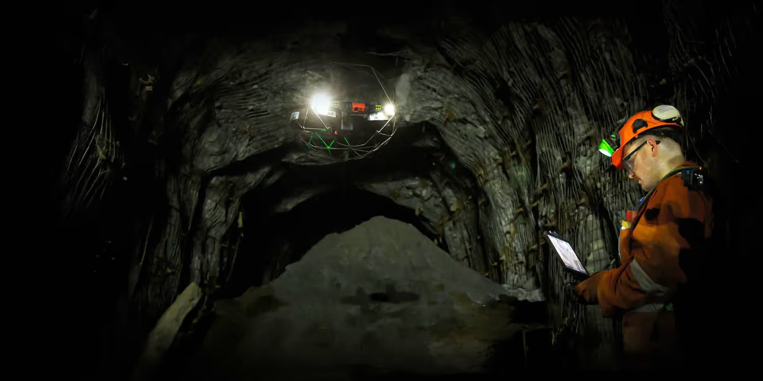
Powered by the latest Ouster REV 7’s supercharged L3 chip, the Elios 3 has the ability to capture points further apart and to detect more usable visual features. This maximizes the chance for the SLAM algorithm to converge when computing 3D models of cylindrical and symmetrical environments such as collectors, chimneys, culverts, or underground galleries.

Which Elios 3 LiDAR payload is right for you?
Get detailed point clouds of even the trickiest indoor spaces, all from a safe spot. With the Elios 3’s Surveying Payload, it’s easy to create clear visual maps of complex areas for accurate mapping and analysis.
Precision 1σ
Precision 2σ
Photon sensitivity
When centimetre-level accuracy counts, mobile scanning beats traditional methods like total stations or terrestrial scanners hands down. With a 100m range, 1,310,720 pts/sec point density, and the ability to cover a 300m tunnel in a single flight, the Elios 3 Surveying Payload can turn days of work into just 10 minutes.

Time: 18 minutes, Coverage: 15%

Time: 18 minutes, Coverage: 50%

Time: 18 minutes, Coverage: 100%

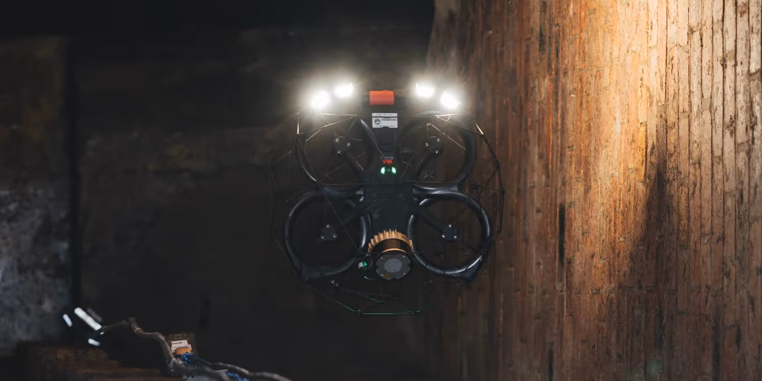
With its small form factor, the Elios 3 and the Surveying Payload can fit through openings as small as 50x50cm. It has a fixed cage that physically protects the hardware and a patented combination of flight controller and motor design that allows the drone to recover flight stability after a collision. This enables the drone to navigate through the most complex environments to capture high resolution scans where no other technology can.
Learn about Elios 3The Elios 3 Surveying Payload is bundled with FARO Connect, a powerful software solution to process and manage the Elios 3’s LiDAR data. Powered by the world’s leading SLAM algorithm, FARO Connect converts data from the Elios 3 into highly accurate point clouds and provides a range of SLAM presets, optimized for the most common data capture scenarios of the Elios 3.

Combine multiple point clouds to produce one single scan using reflective targets.
Automatically georeference point clouds using reflective targets.
Refine Elios 3 3D models with various filters including outlier removal, surface noise reduction, and removal of unwanted points.
Output the processed point cloud data to your required file type: LAZ, LAS, PLY, TXT, and E57.
Get in touch with our team today.