
Real-time 3D data view
For improved situational awareness and easy navigation
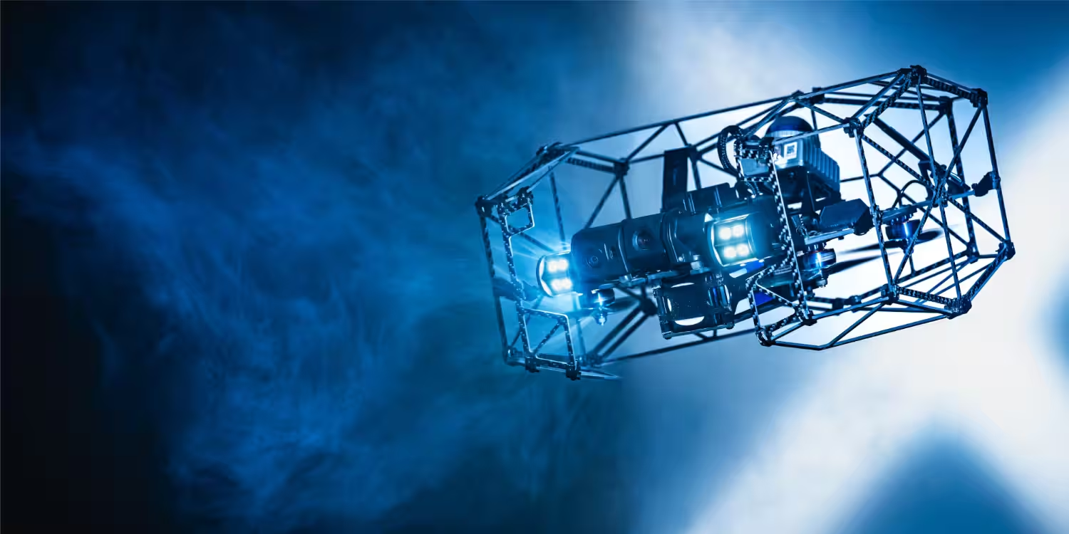
10-minute flight time
With an optional tether for long-duration flights
4K 180° tilt camera
Backed by a powerful LED array for high quality data
Collision resistant cage
Designed to whithstand knocks and bumps
Cloud-based data management
Ensures easy stakeholder sharing and collaboration
LiDAR-powered stable flight
Ensures stable flight in low-light environments
LiDAR ensures steady hovering and flight, overcoming tough conditions such as dust and low light environments, allowing pilots to focus on capturing the data.
Real-time 3D mapping provides situational awareness and ensures safe navigation around obstacles during beyond visual line of sight (BVLOS) operations.
The tethered power module allows for constant power supply, removing the risks of battery exhaustion and the need for swapping batteries.
Terra Xross Cloud allows you to associate images and videos with 3D data for intuitive management. The cloud system facilitates collaboration and easy data sharing with customers and stakeholders.
Featuring a 4K 180° tilt camera and LED illumination, it ensures clear and bright footage in low light and dark environments. The tiltable gimbal allows obstacles to be verified.
See how the Terra Xross 1 compares to other drones built for confined space inspections with our easy comparison matrix.
Get in touch with our team today.