Sewer systems are critical to modern cities, but many are decades old and poorly documented. Traditional surveys often mean days spent underground in confined, hazardous spaces just to confirm pipe locations or conditions before construction work can move ahead.
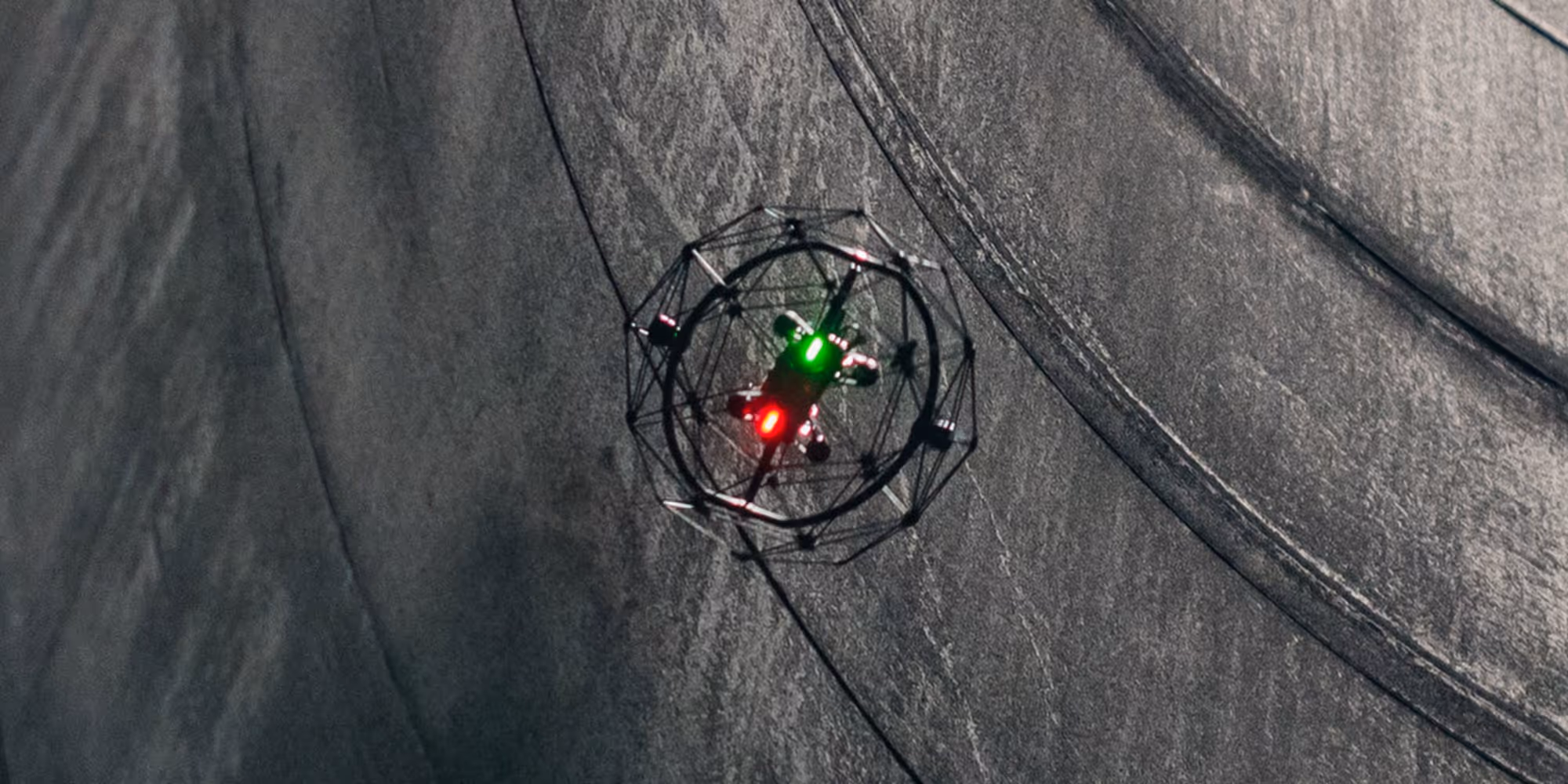
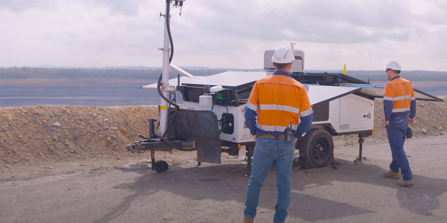
When Northumbrian Water needed a precise survey of a sewer beneath a footbridge scheduled for reconstruction, they turned to Academy Geomatics and the Flyability Elios 3. Using the drone, the team delivered accurate, survey-grade results in hours instead of days, without ever entering the confined space.
Northumbrian Water required an up-to-date survey of a 60-metre sewer tunnel running between two manholes, each with a 10-metre descent. The council overseeing the area needed this data before approving infrastructure improvements.
Traditional survey methods would have demanded rope access, larger crews, and emergency rescue teams, creating unnecessary risk and cost. Academy Geomatics was tasked with finding a safer, faster, and more accurate way to complete the job.
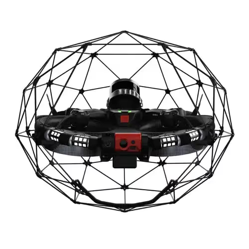
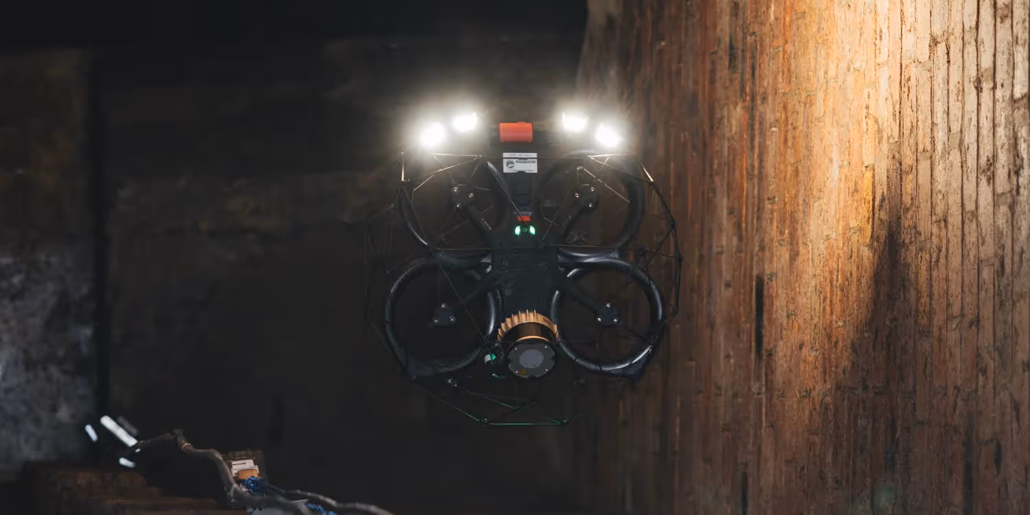
The Elios 3 is purpose-built for hazardous underground environments. Its collision-tolerant cage, centimetre-accurate LiDAR scanner, and 4K inspection camera allow surveyors to capture high-quality data in places where humans cannot safely go.
The drone also integrates with industry-standard software such as FARO Connect and WinCan, streamlining workflows from data collection to final deliverables. An onboard gas sensor adds another layer of protection by monitoring air quality in real time.
For this project, the workflow included:
Mark Anderson, Co-Director of Academy Geomatics, highlighted the advantage of drone access underground:
“The Elios 3 gives us the confidence to enter spaces remotely that would otherwise be unsafe or impossible. We can still deliver the same quality of data without putting our team at risk.”

The survey was completed faster, safer, and with greater accuracy than traditional methods. By replacing rope access and days of manual traversing with just a half-day drone survey, the team saved time, reduced costs, and eliminated confined space risks while still delivering survey-grade outputs.
Anderson summed it up:
“The drone allows us to get data quickly and safely, massively cutting down on time and costs. We can survey four large manholes in a day with the Elios 3, compared to just one using traditional tools.”