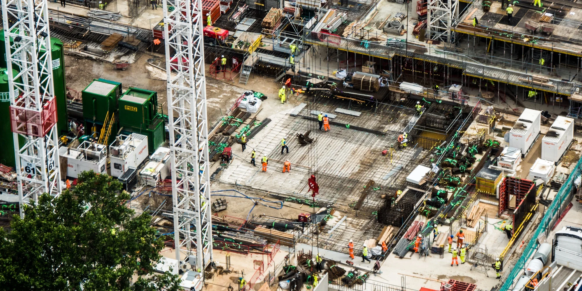
Surveying runs on accuracy and cadence. Site plans, volumes, as-builts and progress claims all depend on current, survey-grade data.
Drone surveying captures that data from the air: faster than ground crews, safer than walking hazardous ground, and accurate enough for engineering work.
Traditional methods struggle to keep pace. Manual measurement is slow and error-prone, and even conventional drone programs depend on a pilot being on site for every flight.
Drone surveying is the use of drones equipped with high-resolution cameras, LiDAR sensors and RTK positioning to capture aerial data that is processed into survey-grade outputs: orthomosaic maps, 3D models, point clouds, contours and volumes.
With an automated dock on site, missions are pre-planned and executed on a schedule, with no pilot travel and no missed weather windows.
For example:
Captured data flows automatically into the GIS, CAD and project-controls systems teams already use.
Topographic Survey and Mapping
Drones capture comprehensive coverage of a site, including areas inaccessible or hazardous for ground surveyors, and photogrammetry turns that capture into accurate terrain models and orthomosaics.
3D Modelling and Point Clouds
Photogrammetry and LiDAR produce detailed 3D models and point clouds of terrain and structures, giving engineering teams a precise digital record of the site.
Volumetric Measurement
Stockpiles, cut-and-fill and pit volumes are calculated from repeatable aerial capture, replacing slow, manual ground measurement.
Progress Monitoring
Regular surveys are compared against previous capture and project plans, so deviations are caught early and decisions are made on current data.
Large sites and linear corridors extend beyond what a pilot can survey within visual line of sight (VLOS).
Beyond visual line of sight (BVLOS) operations allow drones to survey entire sites and corridors while maintaining regulatory compliance and operational safety.
BVLOS capability enables:
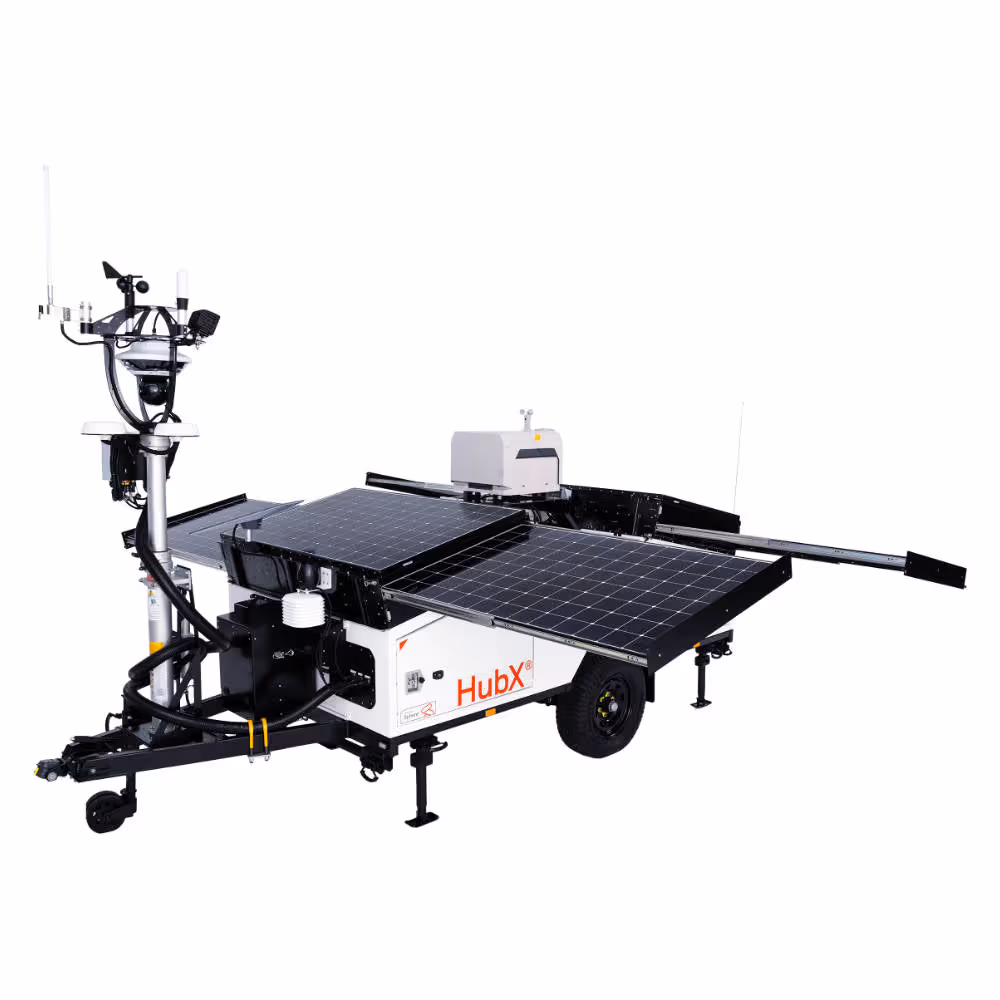
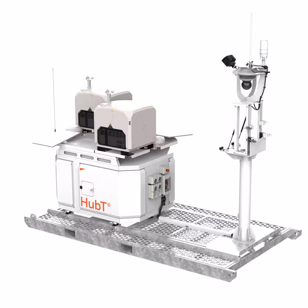
Survey-grade results require more than a drone. They combine automated flight hardware, remote operations, governance controls and automated data delivery into a repeatable workflow.
At Sphere, drone surveying programs combine:
Together, these technologies make surveying a scheduled output rather than a site visit.
Every site is different. The right mix of HubX and HubT depends on your site footprint, survey cadence and how data feeds your engineering and project-controls systems.
A Sphere team member can assess your operation and model automated surveying against your current survey costs.
Book a survey automation assessment to see how drone surveying fits your projects.