Auto Survey IQ
Fully autonomous drone surveying, delivering survey-grade data for construction and mining sites.

.avif)
Fully automated aerial surveys using drone-in-a-box systems
24/7 access to CASA-certified ROC pilots
No on-site operators needed for launch, flight or recovery
Compatible with all mainstream platforms like HubX, HubT & Curo
Proven at scale for high-frequency data capture
Outputs formatted for CAD, GIS & audit reporting
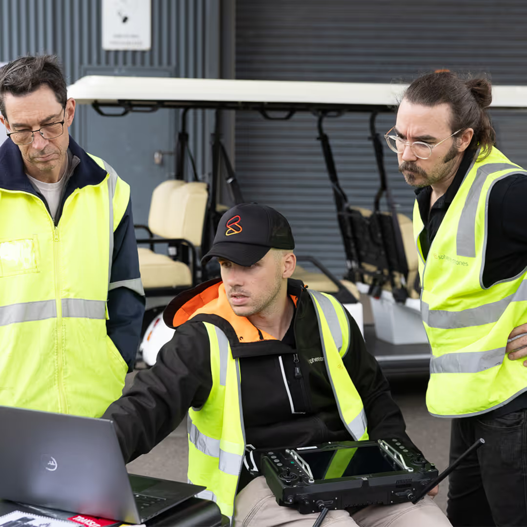
Auto Survey IQ is Sphere’s autonomous drone survey and mapping solution, delivered via drone-in-a-box. It’s designed to help site teams capture reliable, repeatable survey data and without needing to be on-site. Instead of walking stockpiles or manually flying grids, Auto Survey IQ lets you schedule fully autonomous missions flown remotely by certified ROC pilots.
You get clean and audit-ready outputs, aligned to your site and delivered how you need them.

From mining to construction, Auto Survey IQ supports high-impact workflows with safe, repeatable and audit-ready drone data. Whether you're measuring stockpiles, tracking progress or mapping hazardous areas, Auto Survey IQ makes it easy to get the insights you need and without sending crews to site.
.avif)
Monitor stockpile volumes
.avif)
Analyse drill and blast outcomes
.avif)
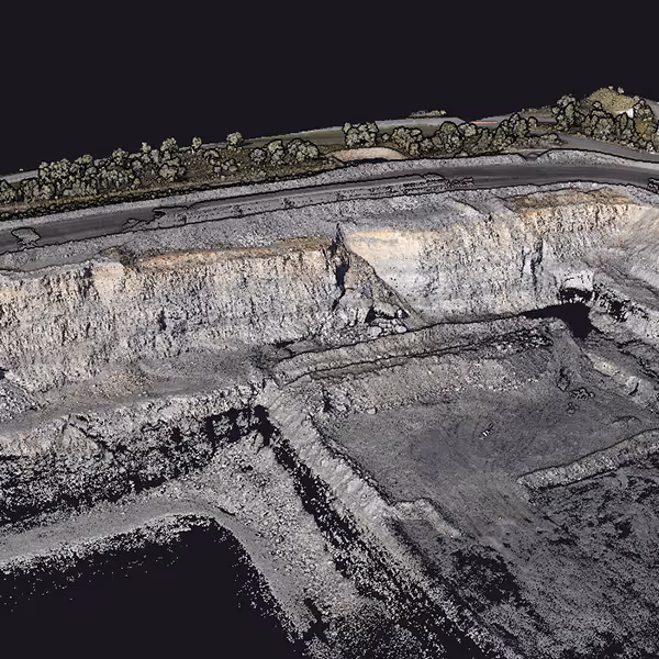
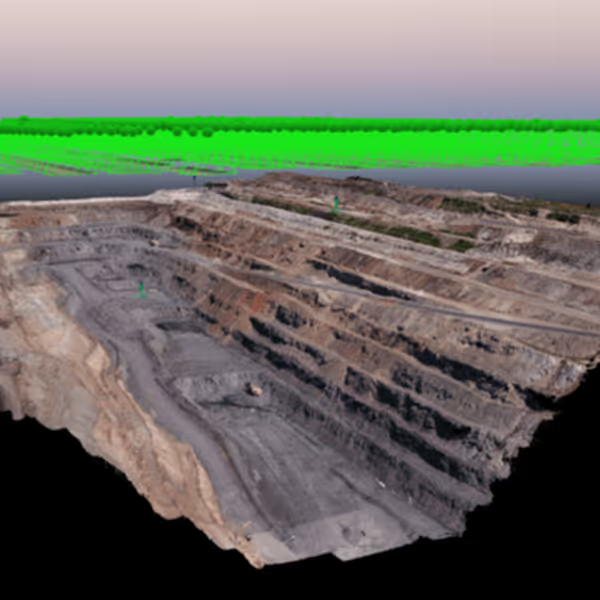
Survey open-pit mine conditions
.avif)
Remote monitoring of satellite & rehabilitation sites
.avif)
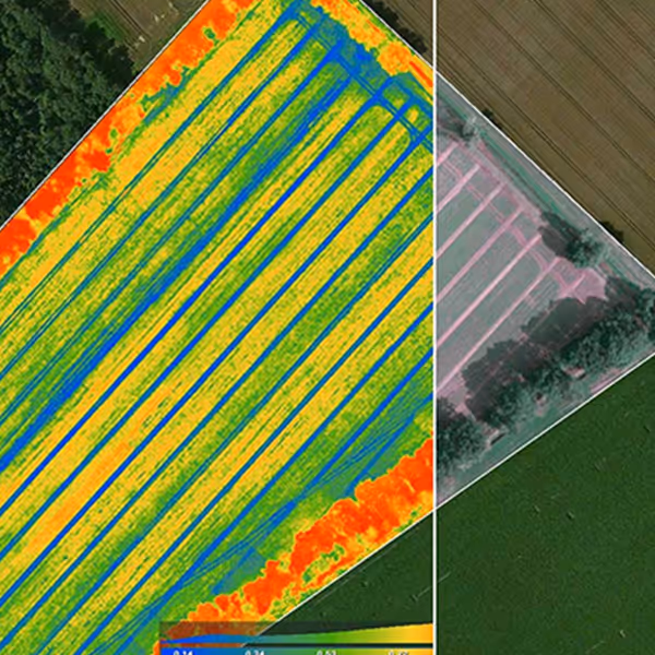
Track terrain change over time
.avif)
Capture data from restricted zones
.avif)
Perimeter security
.avif)
Inspections on critical or remote assets
.avif)
Conduct safe, routine power line inspections
.avif)
Enable automated environmental or asset change detection
.avif)
Measure earthworks & cut/fill volumes
.avif)
Track project progress automatically
.avif)
Document works with aerial maps
.avif)
Remotely inspect unsafe or hard-to-access areas
.avif)
Reduce manual rework with frequent, consistent captures
We deliver the outputs in formats that integrate directly with your existing platforms. All outputs are available via CuroConnect or secure file transfer.
Available formats:

A clear, repeatable process that fits into your workflow.
1
Remote site & project scope review
We start with a review of your survey area, operational conditions, and project specs. We can sort any flight approvals and confirm deliverables upfront.
2
Pre-configured system delivery
Your drone-in-a-box system arrives ready to fly on a HubX or HubT. No fiddly setup, just power it up and connect with remote support to get airborne quickly.
3
Remote survey flights
Missions are planned and executed remotely by our licensed pilots. Whether it’s daily topography or milestone progress, we’ve got you covered.
4
Output delivered to your workflow
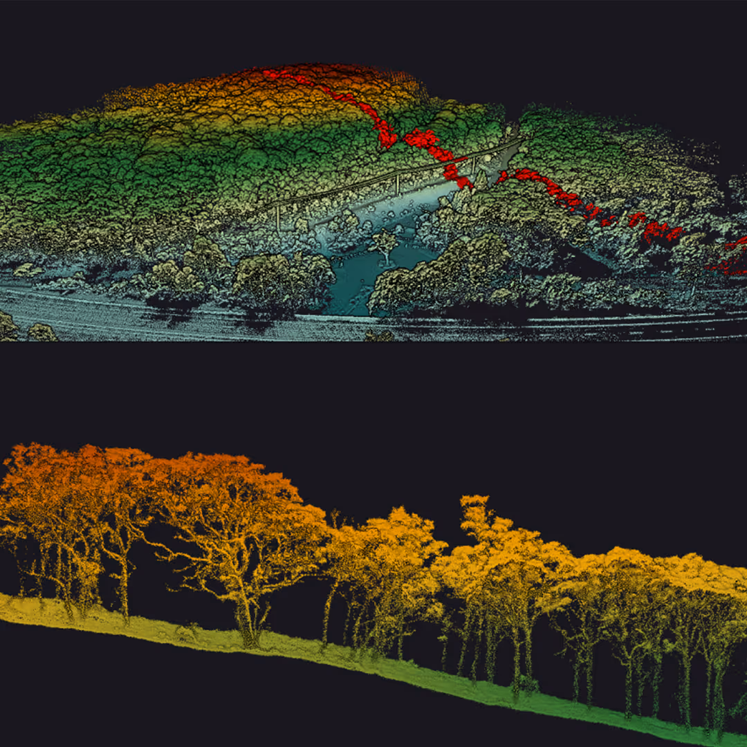
Get your survey outputs: DEM, orthos, point clouds in industry-standard formats, ready for CAD, GIS, or your preferred digital twin platform.

Auto Survey IQ delivers accurate, high-resolution aerial maps and 3D models tailored to your site.
Whether you’re tracking earthworks, validating contractor work or planning with confidence, this is field-ready data you can rely on.
Auto Survey IQ missions are flown by CASA-certified pilots, processed in-house, and delivered in formats your team already works with.
No outsourced ops. No on-site headaches. Just consistent, high-quality data, audit-ready, repeatable and always on time.
Get in touch with our team to see if Auto Survey IQ is the right product for your requirements.